I have an ongoing project in the area of public transport in Dublin, which has a) stagnated for a while and b) grown a bit since I have had to interact more with public transport in Dublin.
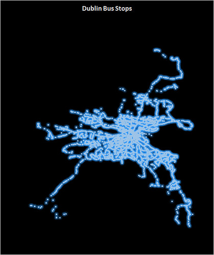
This is one of the items on the project list. This image is a scatter plot of Dublin Bus latitude/longitude values for Dublin bus stops. The file this is based on, which I pulled into Excel to do this (yes, I have other plans involving R at some point which may see this revisited) has more than 4700 datapoints. Looking at it like this, I’m going to see if I can find a similar dataset for street lights. I think it’s a rather beautiful looking spiders’ web.